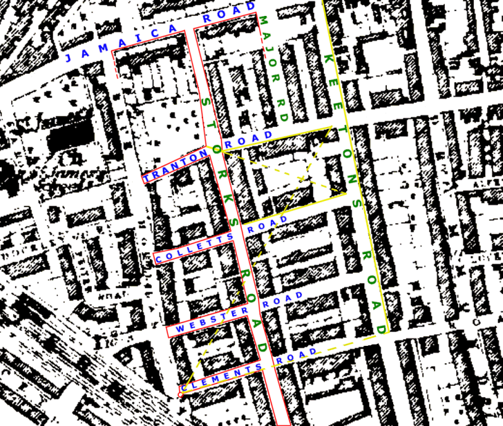
| In trying to understand why there are two 1881 Census records for the Powell family, it is instructive to look at the routes taken by the two enumerators. The route in RED shows a logical progression up and down Storks Road, taking in all the side streets to the West, including Clements Road. The Powell's house (No.2) is marked with a small red circle. The route in YELLOW, although it does do regular sweeps along parts of Tranton Road, Collett Road and Keetons Road, also picks up some isolated dwellings as if the enumerator thought these had been missed earlier. |
![]()